Starting point: Čabrače (750 m)
| Lat/Lon: | 46,1369°N 14,1185°E |
| |
Time of walking: 2 h
Difficulty: easy marked way
Altitude difference: 812 m
Altitude difference po putu: 812 m
Map: Škofjeloško in Cerkljansko hribovje 1:50.000
Recommended equipment (summer):
Recommended equipment (winter): ice axe, crampons
Views: 40.808
 | 2 people like this post |
Access to the starting point:
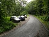
From Škofja Loka, drive towards Gorenjska vas and on to Hotavlje, where you turn right towards Leskovica and the Cerkno ski centre. Just a little further on, you reach the next crossroads, where you turn right towards Volaka and Čabrač. Continue past the Marmor factory Hotavlje and after it you will come to a crossroads, where you continue to the left (direction Volaka and Čabrače). After a few metres of further driving you will come to the beginning of the village Volaka, and we continue a little further to the place where the road to the right turns off towards the village of Čabrače (Čabrače). Take this road, which starts to climb steeply towards the village. Just past the church in the village, you will come to a small crossroads, where you will continue along the upper right-hand road in the direction of Likar Farm. From here, drive for about 200 m and then you will see a suitable parking space on the left side of the road.
Path description:
From the starting point, continue along the asphalted road which, after a short climb, leads to Likar Farm. Behind the houses of the farm, the asphalt ends and the road leads to a crossroads, where we continue to the left in the direction of Blegoš (we will notice a direction sign on the right side of a small brick building). We follow the road for about 5 minutes, then continue to the right along the cart track, which leads us in a few steps along the edge of the grazing pasture (up to here we can also follow the edge of the meadow).
Here you will see a mountain direction sign for Blegoš, which directs you to the left on a narrow and steep path which climbs along the edge of the pasture. The path then crosses lane of bushes, and then leads to the scenic and grassy southern ridge of Blegoš. Continue up the slope, along which you can see several old military bunkers. Higher up, the path gradually turns into forest and after a few minutes of further ascent leads us to the First Level (1289 m), where it is also laid.
Continue slightly to the left along the path, which climbs slightly at first and then begins to descend. During the slight descent, the path passes a larger bunker, after which you enter a forest road, which quickly leads to another wider road, where there is also a marked crossroads.
Continue straight ahead (right Jelovica, left Jelenk) along the road, from which a path soon branches off to the left to Blegoš (the fork is marked).
Take the above-mentioned path, which leads us into the dense forest and after a few minutes leads us to a marked crossroads, where we continue to the right in the direction of Blegoš (left kča to Blegoš and Rupnikova linija). The way forward gradually begins to climb steeper and quickly leads us out of the forest to the increasingly scenic slopes of Blegoš. Follow the above-mentioned path, which leads past another old military bunker, all the way to the top of Blegoš, which is reached after a few minutes of further walking.

Pictures:
 1
1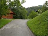 2
2 3
3 4
4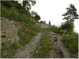 5
5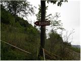 6
6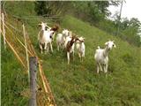 7
7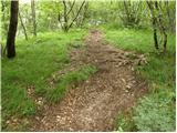 8
8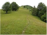 9
9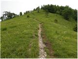 10
10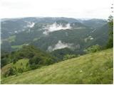 11
11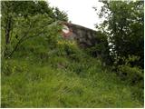 12
12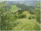 13
13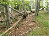 14
14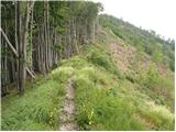 15
15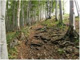 16
16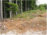 17
17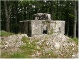 18
18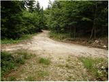 19
19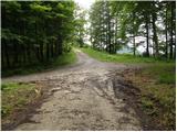 20
20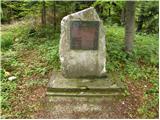 21
21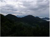 22
22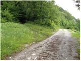 23
23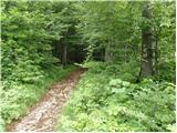 24
24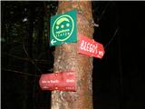 25
25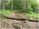 26
26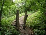 27
27 28
28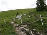 29
29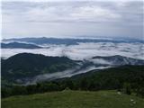 30
30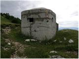 31
31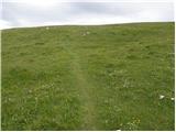 32
32 33
33
Discussion about the trail Čabrače - Blegoš
|
| Johny7730. 06. 2009 |
tale pot na blegaš mi je še najbolša k je sej neki višinske razlike.
|
|
|
|
| turbo14. 12. 2009 |
Omenjeno pot smo Matjaž, Irena in moja malenkost (relativno), prehodili v nedeljo. Vreme in razmere optimalne. Imeli smo meglo, nizko oblačnost, naletavanje snega in sneženje, zmeren mraz in hud mraz. Plus zelo drseče senožeti nad Likarjem (še posebno v sestopu). In bili smo omejeni. Glede vidljivosti, to je razgledov.
Navkljub vsemu ali pa prav zato, je bila naša turica prav super. Snega je razen na vrhu bolj za vzorec, a vseeno ravno dovolj, da po strmih travah ali po listju v gozdu lepo drsi. Previdnost pač ni nikoli odveč.
In tudi kar je napisal Johny77 povsem drži. Vsaj nekaj višinske razlike, da človek pretegne ude in se pošteno nadiha...
|
|
|
|
| Lisica5. 03. 2011 |
Gor je nekaj snega in za dol na nekaterih delih precej drsi, dereze niso odveč.
|
|
|
|
| ljubitelj gora1. 09. 2014 |
V nedeljo popoldne po tej poti na vrh Blegoša, pot je bolj razgledna od ostalih je pa v dobrem stanju.
|
|
|
|
| gregorers11. 06. 2022 18:21:49 |
Lepa in urejena pot. Urejeno je tudi parkirišče
|
|
|