Bresternica (Šoberjev dvor) - Tojzlov vrh
Starting point: Bresternica (Šoberjev dvor) (319 m)
| Lat/Lon: | 46,5856°N 15,5684°E |
| |
Time of walking: 1 h 15 min
Difficulty: easy marked way
Altitude difference: 384 m
Altitude difference po putu: 384 m
Map: Pohorje 1:50.000
Recommended equipment (summer):
Recommended equipment (winter):
Views: 10.305
 | 2 people like this post |
Access to the starting point:
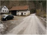
From the road Maribor - Dravograd, in Bresternica (Brestrnica on the maps) you will see signs for the village of Gaj, which direct you to the right (and from the route of Dravograd, to the left). After a few metres, at a poorly marked crossroads, continue to the left and follow the road through the village to the chapel, where you continue to the left. The ascending road leads us higher up to the crossroads at which we see the mountain direction signs for Tojzlov vrh. Park just a few metres further on the roadside parking lot.
Path description:
From the starting point, continue along the asphalted road in the direction of Tojzlov vrh. The road, which climbs only gently along the stream, leads us after a walk of less than 10 minutes to a crossroads where we continue along the left road marked Tojzlov vrh.
The road loses its asphalt coating higher up and leads us to the next crossroads, where we again continue to the left. Further on, the road passes out of the forest onto the viewing slopes, from which we have a beautiful view towards Pohorje and part of Maribor and its surroundings.
The path then leads through the village, beyond which you reach a pleasant resting place by the chapel. We continue along the marked road, which soon returns to the forest and leads us a little higher up to the place where we leave.
The markings direct us to a marked footpath, which, in just over 5 minutes of a slightly steeper climb, takes us up to the mountain lodge.
From the house, follow the cart track, which climbs slightly and after a few steps goes into the forest. Follow this winding path until you reach Tojzlov vrh, which is reached after less than 5 minutes of further walking.

Pictures:
 1
1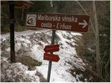 2
2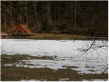 3
3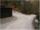 4
4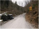 5
5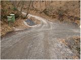 6
6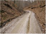 7
7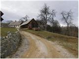 8
8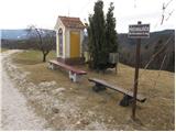 9
9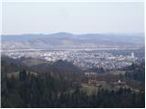 10
10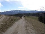 11
11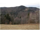 12
12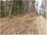 13
13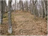 14
14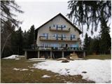 15
15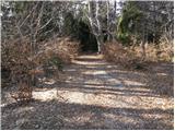 16
16 17
17 18
18
Discussion about the trail Bresternica (Šoberjev dvor) - Tojzlov vrh
|
| nahaha28. 02. 2013 |
Lepa zimska turca, ki smo jo preizkusili sredi februarja. Zadnjih 5 minut se nismo usmerili na markirano peš pot (preveč snega) ampak smo nadaljevali po cesti. Kočo smo dosegli cez ca 10 minut, žal je bila zaprta.
|
|
|