Bresternica (Šiker) - Tojzlov vrh
Starting point: Bresternica (Šiker) (456 m)
Time of walking: 50 min
Difficulty: easy marked way
Altitude difference: 247 m
Altitude difference po putu: 247 m
Map: Pohorje 1:50.000
Recommended equipment (summer):
Recommended equipment (winter):
Views: 15.511
 | 1 person likes this post |
Access to the starting point:
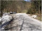
From the road Maribor - Dravograd, in Bresternica (Brestrnica on maps) you will see signs for the village of Gaj, which will direct you to the right (from the route of Dravograd, to the left). After a few metres, at a poorly marked crossroads, continue left and follow the road through the village to the chapel, where you will continue to the left. The ascending road leads us higher up to the crossroads at which we see the mountain direction signs for Tojzlov vrh. We continue here to the left and follow the road for about 1km to the next mountain signs (this time for Žavcarjev vrh) at which we park in one of several small parking lots along the road.
Path description:
From the parking lot, follow the macadam road towards Tojzl Hill and the hunting lodge. After 5 minutes of walking along the road, you will reach the hunting lodge, where the path turns sharp left and turns from the road into cart track.
Continue ascending along the above-mentioned cart track, which climbs steeply through the forest. The path leads us higher out of the forest, where it then continues along the forest flanks. In a moderate ascent along the edge of the forest, the path leads to a road.
The ascent can be continued along the marked road, or along the parallel cart track. In both cases, after a few minutes of further walking, you will reach the mountain lodge.
From the house, follow cart track, which climbs slightly and after a few steps goes into the forest. Follow this winding path all the way to Tojzl Peak, which is reached after less than 5 minutes of further walking.
Pictures:
 1
1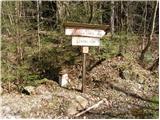 2
2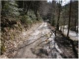 3
3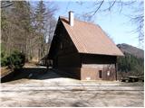 4
4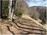 5
5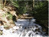 6
6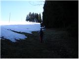 7
7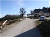 8
8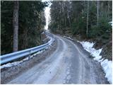 9
9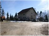 10
10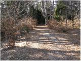 11
11 12
12 13
13
Discussion about the trail Bresternica (Šiker) - Tojzlov vrh
|
| godlike5. 06. 2011 |
Rad bi opozoril, da se pot ne začne pri prvih oznakah za Žavcarjev vrh, ampak pri drugih oznakah.
|
|
|
|
| flandrijec30. 08. 2015 |
Te oznake so takoj za oznakami Žavcarjev vrh naprej pri rdečem mostu na desno. Sedaj je ta oznaka za - Dremljeva pot na Tojzlov vrh - prekrita z vejami in je zelo slabo vidna. Drugače je pot po gozdu in po vrhu pobočja prekrasna z zelo lepim razgledom na pobočja Kozjaka in ostalih hribih SV Slovenije. Danes bil prekrasen dan za družinski kratek izlet z zelo lepim razgledom na vrhu pobočja pri kapelici...cirka 10 min. pod vrhom. Na vrhu prijetna postrežba z novim skrbnikom - mlada družina, ki je pokazala veliki interes za ponovno vzpodbuditev trenutno samotnega vrha. 
|
|
|
|
| planika7729. 11. 2015 |
Ja, res so super ti novi oskrbniki, prijazni in zelo dobra hrana! 
|
|
|