Branik - Sveti Duh (Pedrovo) (on forest path)
Starting point: Branik (87 m)
| Lat/Lon: | 45,8608°N 13,7861°E |
| |
Name of path: on forest path
Time of walking: 1 h
Difficulty: easy marked way
Altitude difference: 278 m
Altitude difference po putu: 290 m
Map: Goriška - izletniška karta 1:50.000
Recommended equipment (summer):
Recommended equipment (winter): crampons
Views: 3.581
 | 2 people like this post |
Access to the starting point:
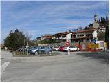
a) From the motorway Ljubljana - Koper, take the exit Senožeče and then continue driving towards the village of Štorje. At Štorje, turn right in the direction of Branik (straight ahead to Sežana and Trieste) and continue through the villages of Kazlje, Dobravlje and Ponikve. At the junction a few kilometres after Ponikve, turn right towards the village of Kobdilj (left Kopriva and Dutovlje), and from there follow the signs for Štanjel and Branik. After a few kilometres downhill, we arrive at Branik, where the road from Komno joins from the left. Just a little further on from this junction, you will see a larger parking lot on the right, where you park (the parking lot is located near the post office and the Mercator store).
b) First drive to Ajdovščina, then continue along the old road towards Nova Gorica. When you reach the settlement Potoče, leave the main road and turn left in the direction of Branik. The road quickly leads to a bridge over the river Vipava, after which it gradually becomes more winding. After a short climb, there is a short descent and you reach Branik. When you reach the main road, turn left and then after a few 10 metres of further driving, turn left into a larger parking lot (the parking lot is located near the post office and the Mercator shop).
c) From Nova Gorica or its surroundings, drive to Dornberk and from there continue in the direction of Branik. Park in the centre of Branik in a large parking lot (located near the post office and the Mercator store).
Path description:
From the parking lot, continue along the main road towards Dornberk, then turn left towards Cvetrož. Soon after leaving the main road, you will see signs for Pedrova at the transformer station. A little further on, the road leads over a bridge over the river Branik, and just after the bridge we continue to the left in the direction of the hamlet of Lojevi (right Cvetrož). A few steps further on, the road splits again, and this time we continue to the right (straight ahead to the Furlan farm and the Pri mlinu agritourism farm). We walk along the asphalt road for only a few more 10 metres, and then, at a nearby residential house, we continue straight ahead towards the railway bridge. When you reach the foot of the railway bridge, follow the marked path which continues under a stone arch. Climb briefly along the bottom of a small valley, then cross a torrent and start climbing steeply on the other side. Higher up, you reach a wooded ridge, and the path immediately switches to the right side of the ridge (looking in the direction of ascent). There is a cross-climb of a few minutes, then you regain the wooded ridge.
Once on the ridge, join cart track (the route from Branik past Branik railway station), which is followed to the right, and we follow it to the first crossroads.
Continue on the left marked cart track (the right one immediately splits into two parts again), which then starts to descend gently. After a short descent, you reach the bed of the torrential Petnik stream and arrive at a metal hunting observation post. Just by the observation post, go slightly left and cross the bed of the above-mentioned intermittent stream. On the other side of the stream, we start to climb steeply up a steeper slope, and the path leads us higher up below the village of Pedrovo. There is a short climb and between the houses you reach the road leading through the village.
Once on the road, turn left (right Trstelj), where after a further 10 steps you will reach the end or beginning of the village, where you will see a small church on the right hand side.

Pictures:
 1
1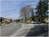 2
2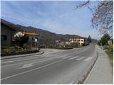 3
3 4
4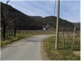 5
5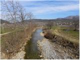 6
6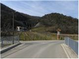 7
7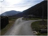 8
8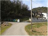 9
9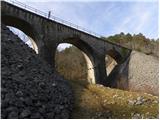 10
10 11
11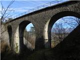 12
12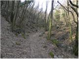 13
13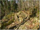 14
14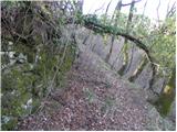 15
15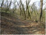 16
16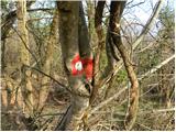 17
17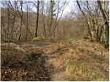 18
18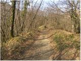 19
19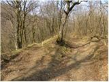 20
20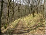 21
21 22
22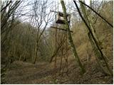 23
23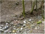 24
24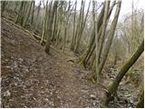 25
25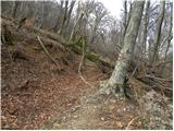 26
26 27
27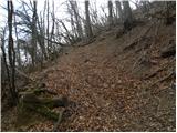 28
28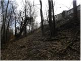 29
29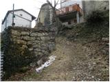 30
30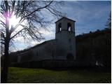 31
31 32
32
Discussion about the trail Branik - Sveti Duh (Pedrovo) (on forest path)