Bistriški jarek (Verdinek) - St. Lorenzen ob Eibiswald
Starting point: Bistriški jarek (Verdinek) (452 m)
| Lat/Lon: | 46,6509°N 15,1234°E |
| |
Time of walking: 2 h 45 min
Difficulty: easy marked way
Altitude difference: 495 m
Altitude difference po putu: 700 m
Map: Koroška 1:50.000
Recommended equipment (summer):
Recommended equipment (winter): ice axe, crampons
Views: 238
 | 1 person likes this post |
Access to the starting point:
a) Drive to Dravograd, then continue to Maribor. After the 8. 0 km road marker, pay attention, because a little after the bus stop and the pedestrian crossing, you will turn left into the Gortina settlement (the exit from the main road is not marked). As soon as you leave the main road you will arrive in Gortina, and we will then drive towards Muta, turning left at the marked crossroads where you will see the signs for Bistriški trench. The road then leads quickly into the Bistriški trench, through which you climb steeply. After the Verdinek homestead and before the 6. 0 km road marker, a dirt road branches off slightly to the right, leading towards the Štrigel homestead. At the crossroads, where there are also red mountain signs slightly to the right, the route described above begins.
b) First drive to Maribor, then follow the signs for Dravograd. Once you have crossed Mučka Bistrica, turn right a little after the Tuš store in the direction of Muta 1. The route leads to Muta, where you follow the priority road at the crossroads, and from a slightly larger crossroads turn left, so that you continue towards Gortina. A little after the Muta settlement ends, turn right at the marked crossroads towards Bistriški trench. The road then quickly leads into the Bistriški trench, through which you climb steeply. After the Verdinek homestead and before the 6. 0 km road marker, a dirt road branches off slightly to the right, leading towards the Štrigel homestead. At the crossroads, where there are also red mountain signs slightly to the right, the route described above begins.
Path description:
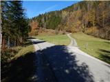
From the starting point, continue slightly further to the right than the side road, on the footpath in the direction of St. Jernej and Bricnika. The path initially ascends across a pasture, then passes into the woods, where it becomes completely flat at a sign. Cross the slopes to the right for a short distance, then continue along the stream. Higher along the stream, the national border is also crossed for a while, but the path leads us higher up to cart track, which we climb for a few minutes. From cart track, the mountain signs then direct us sharp left, and we continue to climb through the forest for a while, before the Lubej homestead, we cross the road.
Before the homestead, continue slightly to the right, on a fainter path, and above the homestead you will reach cart track, which you follow to the right. A few minutes higher up, the well-marked path leads to a crossroads, at which there is an information board with a description of the Knafelč marking with a green ring.
At this crossroads, leave the path leading to St Jerome's Church and turn sharp left onto the path, which lies completely flat and quickly crosses over to the Austrian side of the border. The path soon turns right and leads to an older chapel, where you continue to the left. A few steps further on, the path to Mlaki / Laaken branches off to the left, and a little further on you reach an asphalt road, which you follow to the right. Follow the road to the Puschnigg farm, then leave the road after the farm and continue downhill to the right, crossing a pasture where the track is not visible, and descend to the edge of the forest, where the track and the markings reappear. There is a short descent to a nearby stream, where the path leads past the ruins of Puschnigg Mill / Puschnigg - Mühle, and then climbs up to a dirt road a few minutes away. Once on the road, continue straight ahead, passing the nearby chapel on your right. After the nearby farmhouse, the road changes to cart track, and from cart track, bear right onto a marked path that descends into the woods and crosses another stream a little lower down. There is a slightly longer climb through the forest, and higher up you reach a road which you follow to the right. Go straight ahead at a nearby crossroads, and then signs direct you left onto a footpath which leads to a few houses and a marked crossroads on the road. From the crossroads, continue straight ahead (sharp right to Bricnik), then pass the houses and the chapel to reach the next crossroads, where you go slightly right in the direction of St. Lorenzen. You will quickly arrive in the above-mentioned village, where you will find the church of St. Lorenzen and, slightly below it, the church of St. Lenart.
Description and pictures refer to the situation in 2018 (October).

Pictures:
 1
1 2
2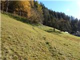 3
3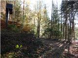 4
4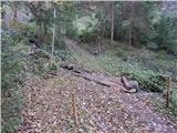 5
5 6
6 7
7 8
8 9
9 10
10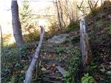 11
11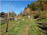 12
12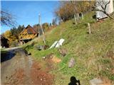 13
13 14
14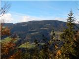 15
15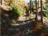 16
16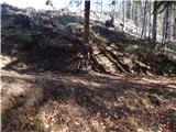 17
17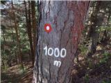 18
18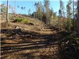 19
19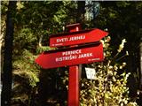 20
20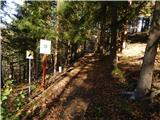 21
21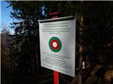 22
22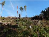 23
23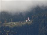 24
24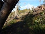 25
25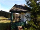 26
26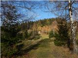 27
27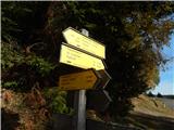 28
28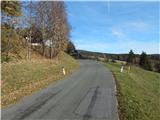 29
29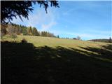 30
30 31
31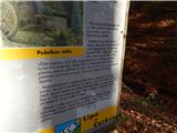 32
32 33
33 34
34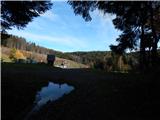 35
35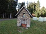 36
36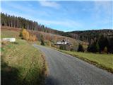 37
37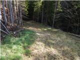 38
38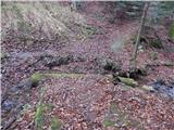 39
39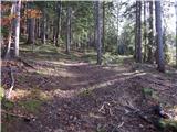 40
40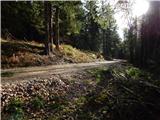 41
41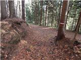 42
42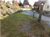 43
43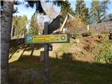 44
44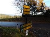 45
45 46
46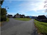 47
47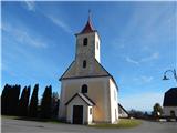 48
48
Discussion about the trail Bistriški jarek (Verdinek) - St. Lorenzen ob Eibiswald