Bašelj - Sveti Lovrenc (Bašelj) (via Gradišče)
Starting point: Bašelj (590 m)
| Lat/Lon: | 46,321°N 14,4002°E |
| |
Name of path: via Gradišče
Time of walking: 1 h 10 min
Difficulty: easy marked way
Altitude difference: 302 m
Altitude difference po putu: 350 m
Map: Karavanke - osrednji del 1:50.000
Recommended equipment (summer):
Recommended equipment (winter): ice axe, crampons
Views: 6.585
 | 1 person likes this post |
Access to the starting point:
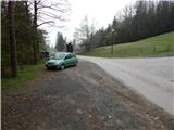
a) From the motorway Ljubljana - Jesenice, take the exit Kranj - East, then continue driving towards Jezersko. When you reach Preddvor, leave the main road and turn left towards the centre of the town, and from there follow the signs for Bašelj. When you reach Bašelj, at the point where the main road makes a long left turn, leave the main road and continue straight ahead in the direction of the Gamsova cesta (Gamsova cesta). Continue along the narrow asphalt road that leads between the houses and the Belica stream. Park in the parking lot next to the Bašelj Tourist Board.
b) From the motorway Jesenice - Ljubljana, take the exit Kranj - West and turn left at the first junction. Continue through the underpass under the motorway and then to the roundabout, from where you continue in the direction of Golnik. The road continues through Mlaka pri Kranju, and at the end of the village we turn right in the direction of Srakovlje. We then drive through Srakovlje, Spodnja Bela, Srednja Bela, Zgornja Bela (in Zgornja Bela we join the road from Preddvor) to Bašlja, where the main road makes a long left turn, we leave it and continue straight on in the direction of Gamsova cesta. Continue along the narrow asphalt road which leads between houses and the Belica stream. Park in the parking lot next to the Bašelj Tourist Board.
Path description:
From the starting point at the log cabin of the Bašelj Tourist Association, continue along the forest road closed to public traffic, which leads us along the Belica stream. At first we walk along the football and basketball pitches, then we arrive at the first crossroads of the gams' trail, where the trail branches off to the left towards the Church of St. Lawrence, the Lodge under St. Lawrence, and it is also possible to continue towards Storžič, Krničarjeva koča na planini Javornik, Mali and Velika Poljana. . .
From the above mentioned crossroads, the ascent continues along the macadam road, which climbs moderately through the forest or partly through the bushes. After a few minutes, we arrive at the forest road turning point, where the footpath to Kališe continues to the right across the stream, and slightly to the left the gamsova trail continues, leading to Gradišče and further to St. Lovrec, and the path to Kališe along the forest road, Kališe past the Košuta Hospital and Kališe along the ridge of Kisovec. The path continues along the wide cart track, climbing towards the nearby water reservoir. Before the water reservoir, leave the wide cart track and continue again slightly left, on the path where the gams' trail continues. Continue for a few minutes on the steeper cart track, and when this ends, continue right on a less distinct but relatively well beaten path that climbs through the forest. Higher up, the track is partly lost in a few places, and we follow the otherwise sparse yellow and white markings that mark the gams' path. We climb through the forest for a few minutes, then at one bend we reach another forest road, which we follow to the right (to the left Laško). We walk along the dirt road for a few 10 metres and we are at the next crossroads, where the path to St. Lovrenec branches off to the left.
From this crossroads, walk along the road for only a few steps, and then on the right, by the sign marking the private parking area, continue right on the beaten track, which in a minute or two of further walking will take you to the top of Gradišče, where there is a small wooden hut.
From Gradišče, return to the forest road, or a few steps back, and then from the crossroads continue along cart track in the direction of St. Lawrence. Cart track first leads us over a nearby ravine and then the signs lead us to the left to a path which first crosses the ravine, then crosses it on the other side and climbs over a slightly exposed passage where greater caution is needed, especially in wet conditions. The exposed part is short, so that it does not cause any particular problems. The path continues into the forest, where it crosses at first steeper slopes, and then, in a few short ascents and descents, leads to a marked path leading from St. Lovrenec towards Storžič, Kališe, mountain pasture Javornik. . . When you reach the marked trail, follow it to the left, initially slightly downhill. After a short descent, you reach a marked crossroads, from where you continue straight ahead in the direction of St. Lawrence (left Bašelj). There is a moderate climb through the forest for a few minutes, and then you emerge from the forest into a larger meadow, in the middle of which is the church of St. Lawrence, from which you have a beautiful view.

Pictures:
 1
1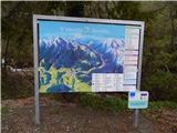 2
2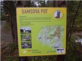 3
3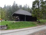 4
4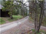 5
5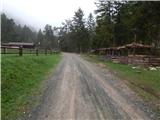 6
6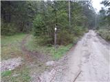 7
7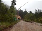 8
8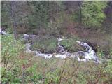 9
9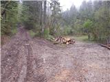 10
10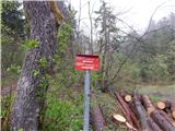 11
11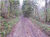 12
12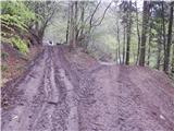 13
13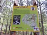 14
14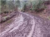 15
15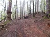 16
16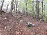 17
17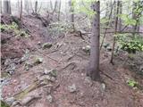 18
18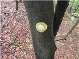 19
19 20
20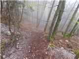 21
21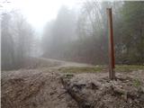 22
22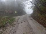 23
23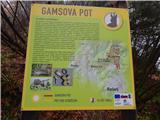 24
24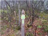 25
25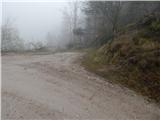 26
26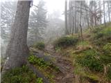 27
27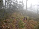 28
28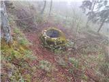 29
29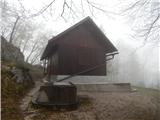 30
30 31
31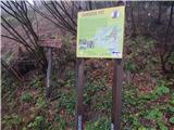 32
32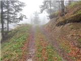 33
33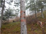 34
34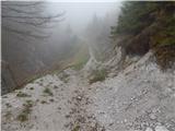 35
35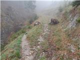 36
36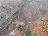 37
37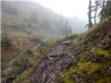 38
38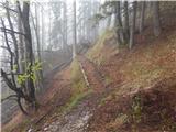 39
39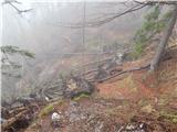 40
40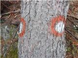 41
41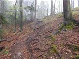 42
42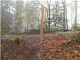 43
43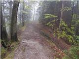 44
44 45
45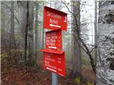 46
46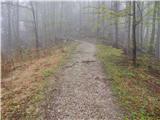 47
47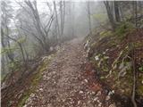 48
48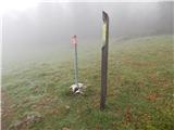 49
49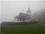 50
50
Discussion about the trail Bašelj - Sveti Lovrenc (Bašelj) (via Gradišče)