Rute (Zavrh) / Bärental - Barentaler Kotschna/Struška (via Bärensattel)
Starting point: Rute (Zavrh) / Bärental (960 m)
| Lat/Lon: | 46,4702°N 14,1564°E |
| |
Name of path: via Bärensattel
Time of walking: 2 h 45 min
Difficulty: easy marked way
Altitude difference: 984 m
Altitude difference po putu: 984 m
Map: Karavanke - osrednji del 1:50.000
Recommended equipment (summer):
Recommended equipment (winter): ice axe, crampons
Views: 9.474
 | 2 people like this post |
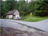
Access to the starting point:
Cross the Ljubelj border crossing and descend to the Austrian side, then take the Bistrica v Rožu / Feistritz exit at the second roundabout (just before the bridge over the River Drava). Continue to the above-mentioned place, where signs for Rute / Bärental direct you to the left on the ascending road, which after a few km leads you to the above-mentioned village, where you park in a roadside parking lot (there are signs for Barentaler Kotschna / Barentaler Kotschna next to the parking lot).
Path description:
From the parking lot, turn right onto the asphalt road towards "Bärensattel". After a few dozen steps, the road leads to the Stouhütte inn, after which you leave the inn and take the footpath in the direction of "Bärensattel". The path then turns left just after a small flight of steps and crosses a dirt road at a slightly higher level. Continue up a pleasant forest path, which leads you higher up to the partly abandoned Žnidar farm, where you take a sharp left. The path goes on into the forest again and, after a short moderate climb, leads us to a hunting observatory (if we climb to the top, we get a nice view across the Drava Valley). The way forward gradually becomes steeper and steeper and leads us higher under smaller cliffs, where our pleasant walk is stopped by rubble, after which we have to climb steeply up (taking care especially when descending). The steepness then subsides and the path leads us past an intermittent spring to the Medvedjak / Bärensattel saddle.
Here, continue right along the boundary ridge in the direction of the "Barentaler Kotschna" (straight mountain pasture) for 5 minutes on a path that climbs between the dwarf pines. The relatively steep path leads higher up to the Barentaler Kotschna headland, from which you descend a few tens of steps. After this descent, cross a small valley and, after a few steep steps, climb a ridge which you follow through dwarf pines to a grassy and scenic summit.
Starting point - Medvedjak 1:45, Medvedjak - Barentaler Kotschna 1:00.

Pictures:
 1
1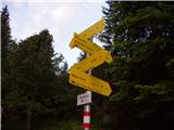 2
2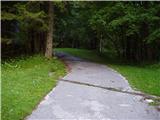 3
3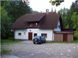 4
4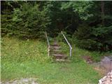 5
5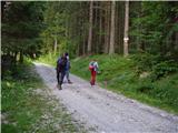 6
6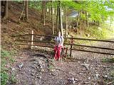 7
7 8
8 9
9 10
10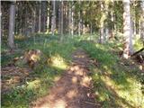 11
11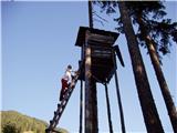 12
12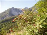 13
13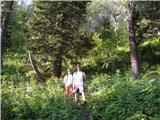 14
14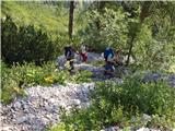 15
15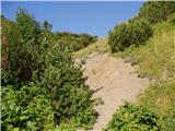 16
16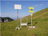 17
17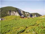 18
18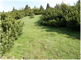 19
19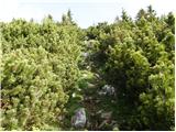 20
20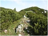 21
21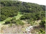 22
22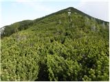 23
23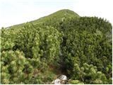 24
24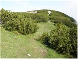 25
25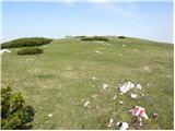 26
26 27
27
Discussion about the trail Rute (Zavrh) / Bärental - Barentaler Kotschna/Struška (via Bärensattel)
|
| heinz6. 11. 2009 |
1.Zanima me del poti prek grušča, kjer je potrebna previdnost pri sestopu. Na zemljevidu je namreč pot označena s prekinjeno rdečo črto, -kot zahtevna. V nasl. dneh nameravam obiskati Stouhuette z Javorniškega rovta.
2. Je na poti možen kak odcep za Geissberg- Kozjak?
Hvala, srečno, heinz!
|
|
|
|
| Tadej6. 11. 2009 |
Pot čez grušč ni zahtevna, previdnost je potrebna predvsem zaradi kamenja, ki nam spodnaša ravnotežje. Padec bi bil trd, ne pa tudi usoden (razen, če padeš direktno na glavo), saj pobočje ni pretirano strmo. Slika 15 http://www.hribi.net/slika.asp?pot=31554 Do Celovške koče boš najhitreje prišel, če iz Medvedjega dola (dolina na avstrijski strani) nadaljuješ kar po cesti. Lp Tadej
|
|
|
|
| heinz6. 11. 2009 |
Tadej, hvala! Se mi je zdelo, da ne more biti hudega, saj je tudi pot: Sedlo Belščica- Celovška koča (nezahtevna) označena na enak način..
Za pot na Geissberg pa še preračunavam, kje se bolj izplača, npr- Tinčkova koča, Zagon, Belščica, Cel. koča, ali ta- Trilobit, Seča, Medvedji dol, Mačenska pl.
Slednja mi je na oko daljša..
Mogoče veš, kje se nahaja Heider-jev spomenik (grob)? Menda nekje v Zavrh-u oz. Rute.
Lp heinz!
|
|
|
|
| Gorazd G6. 11. 2009 |
Grob/spomenik je pred cerkvijo Sv. Mihaela nad Stouhütte - pri novi cerkvi, stara je precej višje. Na Ovčji vrh/Kozjak je najbolj naravno odtod. Seveda pa je treba z avtom naokoli 
|
|
|
|
| Gorazd G6. 11. 2009 |
Mimo spomenika smo šli poleti od Stouhütte na Mačenski vrh. Do domačije Plavc je gozdna cesta, od tam pa se nam ponuja lepa krožna tura po markiranih poteh.
|
|
|
|
| heinz6. 11. 2009 |
O.k. hvala!
Koliko ste potrebovali od Stouhuette do Mačenskega v.?
Tam se menda ponujajo lepi panoramski razgledi..
LP heinz!
|
|
|
|
| Gorazd G6. 11. 2009 |
Hm, zdaj si me pa našel Ura pri naju v hribih (odkar smo trije seveda), ni več gospod in če je vreme stabilno, sploh ne gledava nanjo. Prej je bilo treba velikokrat narediti orng časovnico, da se je izšlo do teme, zdaj se pa lepo sprehajamo in vmes počivamo, jemo, previjamo ...  A če vseeno poskusim ... Za krožno pot od Stouhütte bi po moje zadostovalo štiri do pet ur hribovskega tempa - z razgledovanjem vred. Z vršne pleše se res daleč vidi Zgoraj je obširna planja. Južni greben je kar strm, tod smo šli gor. Pot ponekod pelje nad odlomom, ki se ga lepo vidi s Struške. Vzhodni (sestopni) je v glavnem položnejši. Steza (v spodnjem delu je treba na razcepih kolovozov in stezic malo "loviti" markacije) pripelje do "starega Mihaela". Od te cerkve sredi travnika je tudi lep razgled na Stol in okoliške vrhove.
|
|
|
|
| heinz6. 11. 2009 |
Najlepša hvala za vse informacije!
Srečno, heinz!
|
|
|