Bajdiše / Waidisch - Borovski vrh (Žehtar) / Sechter
Starting point: Bajdiše / Waidisch (547 m)
| Lat/Lon: | 46,4945°N 14,3483°E |
| |
Time of walking: 3 h
Difficulty: partly demanding marked way
Altitude difference: 902 m
Altitude difference po putu: 940 m
Map: Karavanke - osrednji del 1:50.000
Recommended equipment (summer):
Recommended equipment (winter): ice axe, crampons
Views: 366
 | 1 person likes this post |
Access to the starting point:
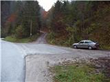
Via Border crossing Ljubelj, drive into Austria, then follow the main road towards Klagenfurt, but only as far as Podljubelj / Unterloibl, where you turn right towards the Hofer store and the police. At a lower level we arrive in Borovlje / Ferlach, where we cross the railway line, and a little further on we go right towards Bajdiše / Waidisch. The road leads past the Eurospar shop, and we follow the main road to Bajdiše / Waidisch, where a little beyond the fire station, the inn and the church, near the road sign marking the end of the settlement, we see on the right the mountain signs for Ferlacher Horn / Ferlacher Horn. There is no suitable parking at the trailhead, so park a little earlier or a little higher up on the main road in a suitable place.
Path description:
From where you parked, first walk to the start of the marked trail and then head towards Grlovec / Ferlach Horn. Cross the Bajdiška Borovnica / Waidischbach stream over a bridge and the path leads to a meadow. On the other side of the meadow, you will see markings that lead you into the forest. The path immediately climbs steeply and ascends above a torrential stream, which can be heard to the right below us. The path soon turns slightly to the left and leads to a forest road. Follow the road for a short distance, to a point where signs direct you to the right onto a footpath. After ten minutes, the path leads us back to the forest road. Continue right up the path and it leads to the small hamlet of Grlovčnik / Herlotschnik farm, after which the waymarked path turns left onto cart track. Cart track, which climbs crosswise along the fence, soon turns right and leads to a hunting observation post, which stands in a small clearing. Just a few steps further on, the path crosses a forest road and climbs through a rather overgrown meadow. The trail crosses the forest road several more times, and then signs direct you to the left along the forest road, which you follow for 100 m to a place where a footpath branches off to the right and then crosses the forest road twice more. At a height of approximately 1400 m, a cross stands at the road crossing, and just above the sign you arrive at a marked crossroads.
From the crossroads, continue right towards Borovlje / Ferlach (Ferlacher Horn on the left) and soon reach a dirt road, which you follow to the right and follow to the first serpentine.
The road leading to the valley, which we crossed several times on the ascent, continues sharp right, and we continue straight on the marked path towards Borovlje. There is some scrambling and a short, slightly exposed descent, and then we reach the ridge connecting Ferlacher Horn and Borovski vrh.
We continue along the ridge, and when the wider path from the ridge passes to the west side of the ridge, we continue straight ahead and continue walking along the ridge (slightly to the left Borovlje). The path along the ridge climbs moderately at first, but steeply higher up. Just below the summit, we leave the forest and quickly climb a very steep path to the summit.

Pictures:
 1
1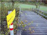 2
2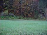 3
3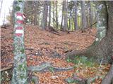 4
4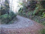 5
5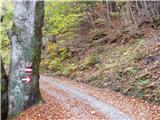 6
6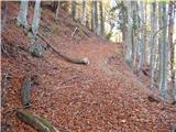 7
7 8
8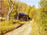 9
9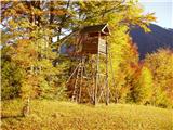 10
10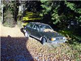 11
11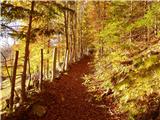 12
12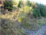 13
13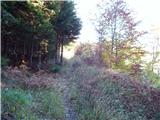 14
14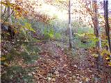 15
15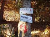 16
16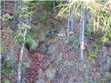 17
17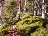 18
18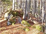 19
19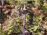 20
20 21
21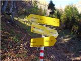 22
22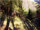 23
23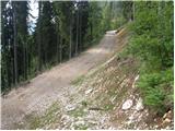 24
24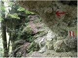 25
25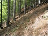 26
26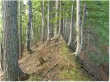 27
27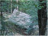 28
28 29
29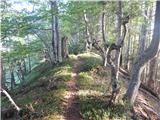 30
30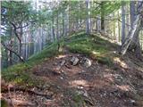 31
31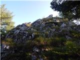 32
32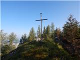 33
33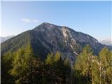 34
34
Discussion about the trail Bajdiše / Waidisch - Borovski vrh (Žehtar) / Sechter