Bachwinkl - Großer Hundstod
Starting point: Bachwinkl (840 m)
| Lat/Lon: | 47,44875°N 12,85419°E |
| |
Time of walking: 7 h 30 min
Difficulty: difficult marked way
Altitude difference: 1754 m
Altitude difference po putu: 2065 m
Map:
Recommended equipment (summer): helmet
Recommended equipment (winter): helmet, ice axe, crampons
Views: 1.617
 | 2 people like this post |
Access to the starting point:
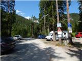
Drive through the Karavanke Tunnel into Austria, then continue along the Turkish Autobahn. We continue through the Katschberg Tunnel and later the Thuringian Tunnel / Tauerntunnel, and follow the motorway to Salzburg (aka Solnograd) only as far as the exit for Bischofshofen, from where we continue on the four-lane road to the aforementioned town. From Bischofshofen, follow the signs for Zell am See and then Saalfelden. Continue straight on the main road through Saalfelden, and just before the sign marking the end of the town, turn right onto a narrow road marked 'Pabing - Bachwinkel'. As you drive through the village, follow the signs towards the Peter Wiechenthaler Hütte. Signposts then direct you to the left onto a dirt road. Park in the large parking lot in front of the bridge.
Path description:
From the parking lot, continue along the macadam road, which is closed to traffic. Walk along the road and at the crossroads follow the signs for the Peter Wiechenthaler Hütte hut. The road crosses two streams at the beginning and then leads to a lock.
Here, turn right onto the footpath and start climbing slightly steeper through the forest. Higher up, we briefly rejoin the road, which leads us to a marked crossroads. At the crossroads, turn left onto the footpath marked 'Peter Wiechenthaler Hütte - 412', and continue along the road towards the mountain pasture Steinalm and the 412e (Seilbahnweg) towards the Peter Wiechenthaler Hütte hut.
From the crossroads, the ascent is mostly in switchbacks through the forest, which rarely opens up a view towards Saalfelden. Higher up, the path turns right and then crosses the slopes to the north-east. The path passes through woodland throughout and there are occasional benches along the way, which have been given names. This path then leads to a crossroads at 1345 metres.
At the crossroads, bear slightly right after the signs "Peter Wiechenthaler Hütte - 412", with paths 412a and 412d to the left, also leading to hut Peter Wiechenthaler Hütte, and 412e to the right, leading back down to the starting point. From the crossroads, the trail crosses the slopes to the north-east for a while, then turns left and starts climbing again a little steeper. The forest becomes a little thinner and views of the nearby peaks begin to open up from the path. Higher up, the forest is replaced by dwarf pines and there are a few more climbs up to the hut.
At the hut, continue past the cable car to a crossroads at which you continue to the left, following the signs "Ingolstädter Haus", and to the right is the trail to the Persailhorn. The trail then crosses the slopes to the north-east. Soon the path branches off to the left downhill towards the mountain pasture Weißbachlalm, and we continue straight on, continuing to cross the slopes below the peaks of the Persailhorn and the Achselhorn. Later, the path turns slightly left and crosses mostly grassy slopes as it ascends. In a few places where the slope is steeper, we are also helped by a cable car. Higher up, the path starts to climb a little steeper and, with the help of some fixed safety gear, leads us to the Weißbachlscharte notch where there is a crossroads. At the notch where the view to the north opens up, continue straight ahead and start descending, with the path to the right leading to the summit of the Mitterhorn. The path here follows the northern slopes eastwards and then leads to a crossroads. From the Weißbachlscharte notch to the aforementioned crossroads, the descent is approximately 100 metres.
At the marked crossroads, turn left towards hut Ingolstädter Haus, straight ahead towards the Kärlinger Haus and sharp right towards the Riemannhaus. From the crossroads, the trail heads north-west and soon descends a little further. The trail then follows a relatively level, mainly rocky terrain, with occasional gentle ascents and descents. Later on, the path called Eichstätter Weg turns slightly to the left and starts to climb a little steeper. Here the path leads us past some potholes and soon we also have a view towards the Ingolstädter Haus hut. This path then leads to a crossroads where a path branches off to the left towards the top of the Schindlköpfe.
At the crossroads we continue to the right and there is a relatively gentle crossing to the Ingolstädter Haus hut.
At the hut, continue northwards following the signs "Hundstod 2594m". Initially still a gentle path, it quickly leads to rocky slopes where you start to climb. The path from which we have a nice view of the nearby peaks continues to climb and leads us past some potholes. This path then leads us to the Hundstodscharte notch where there is also a crossroads.
We continue to the right, following the "Hundstod" signs, and to the left a climbing route leads along the south-west ridge. From the crossroads the route becomes a bit more difficult and climbs steep slopes for some time. In some places the path is also slightly exposed, so some caution is needed. Higher up, the slope becomes a shade less steep and we are soon joined on the left by a more challenging path along the south-west ridge. We continue slightly to the right and then climb up the rocky slope to the summit, which we can already see in front of us.

Pictures:
 1
1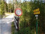 2
2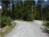 3
3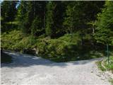 4
4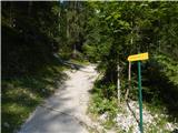 5
5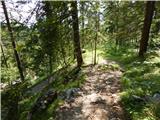 6
6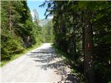 7
7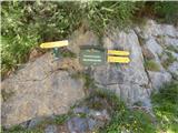 8
8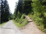 9
9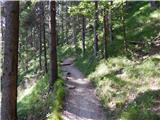 10
10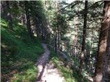 11
11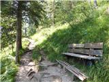 12
12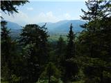 13
13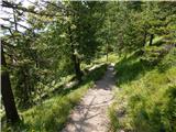 14
14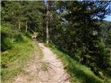 15
15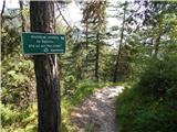 16
16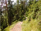 17
17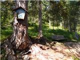 18
18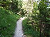 19
19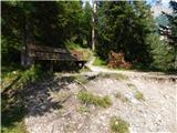 20
20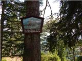 21
21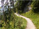 22
22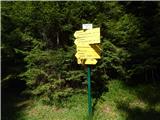 23
23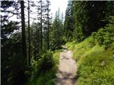 24
24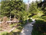 25
25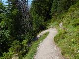 26
26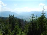 27
27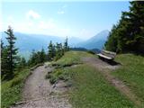 28
28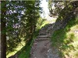 29
29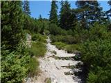 30
30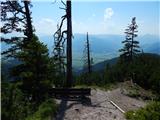 31
31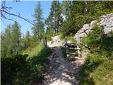 32
32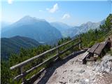 33
33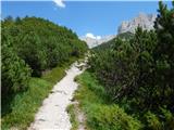 34
34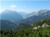 35
35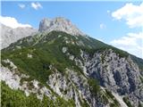 36
36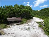 37
37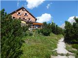 38
38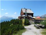 39
39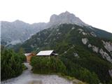 40
40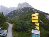 41
41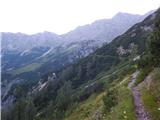 42
42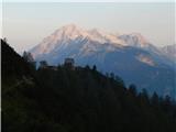 43
43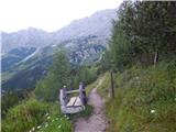 44
44 45
45 46
46 47
47 48
48 49
49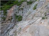 50
50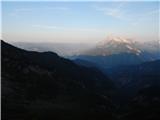 51
51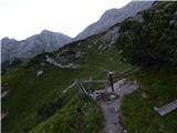 52
52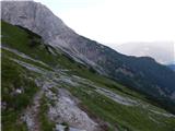 53
53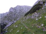 54
54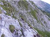 55
55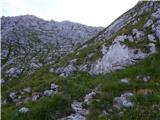 56
56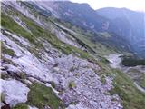 57
57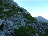 58
58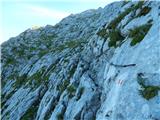 59
59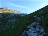 60
60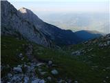 61
61 62
62 63
63 64
64 65
65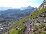 66
66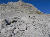 67
67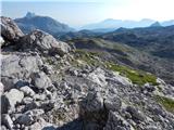 68
68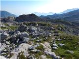 69
69 70
70 71
71 72
72 73
73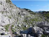 74
74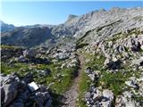 75
75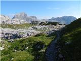 76
76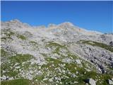 77
77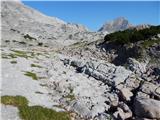 78
78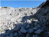 79
79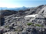 80
80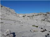 81
81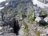 82
82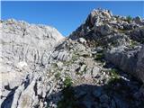 83
83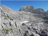 84
84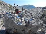 85
85 86
86 87
87 88
88 89
89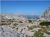 90
90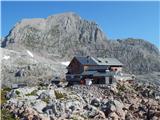 91
91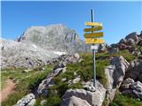 92
92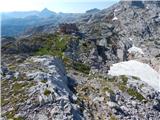 93
93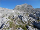 94
94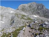 95
95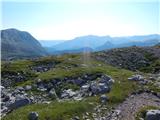 96
96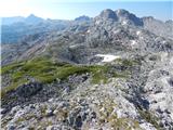 97
97 98
98 99
99 100
100 101
101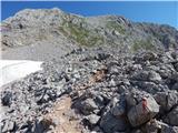 102
102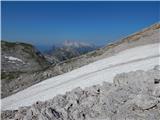 103
103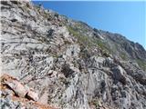 104
104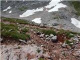 105
105 106
106 107
107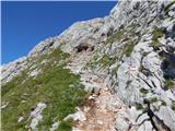 108
108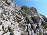 109
109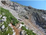 110
110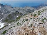 111
111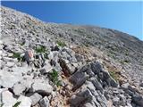 112
112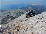 113
113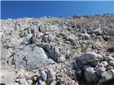 114
114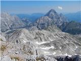 115
115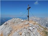 116
116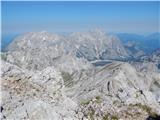 117
117 118
118
Discussion about the trail Bachwinkl - Großer Hundstod