Starting point: Athens (270 m)
Time of walking: 2 h 30 min
Difficulty: easy marked way
Altitude difference: 756 m
Altitude difference po putu: 756 m
Map:
Recommended equipment (summer):
Recommended equipment (winter):
Views: 359
 | 1 person likes this post |
Access to the starting point:
The starting point of the route is in Athens, 270 metres above sea level, at the foot of a hill at the end of Egeou Pelaous Street in the Agia Paraskevi neighbourhood.
Path description:
There is a motorway running along the western side of the hill; we cross it through one of the tunnels. The path initially leads through a low pine forest, but soon the pines disappear and are replaced by bare rock and scrub. We can see Athens to the west and the airport and the sea to the east.
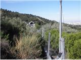
There is also a road leading to the top of Hymettus, which is also used by cyclists. There are a number of transmitters just below the summit, but access to the summit itself is forbidden due to military installations.
Pictures:
 1
1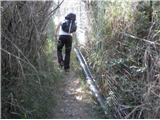 2
2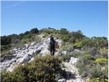 3
3 4
4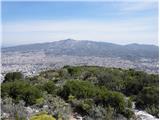 5
5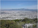 6
6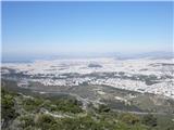 7
7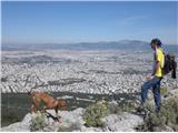 8
8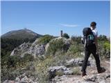 9
9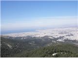 10
10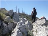 11
11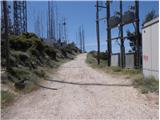 12
12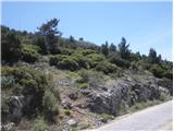 13
13
Discussion about the trail Athens - Hymettus