Valbonë - Viewpoint above Valbona (east path)
Starting point: Valbonë (930 m)
| Lat/Lon: | 42,45531°N 19,89623°E |
| |
Name of path: east path
Time of walking: 2 h 30 min
Difficulty: easy marked way
Altitude difference: 620 m
Altitude difference po putu: 650 m
Map: Peaks of the Balkans 1:60000, Prokletije - Durmitor - Albanian and Montenegro Alps 1:65000
Recommended equipment (summer):
Recommended equipment (winter):
Views: 774
 | 3 people like this post |
Access to the starting point:
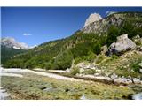
The Valbonë Valley is located in the harder to reach north-eastern part of Albania, and is best reached from the west by a long, several-hour drive on a very winding and sometimes bad road from Skadar via Pukë and Bajram Curri. Part of the journey can be made by ferry on Lake Komani (in this case, do not go via Pukë).
In the Valbonë valley there is a place of the same name. The starting point for the climb is at the first left turn in Valbonë. At this turn the valley opens up nicely, you see a huge torrential gravel pit and quite a few houses. On the bend, to the right of the road, there is a concrete bridge. Next to the bridge is a large wooden sign marking the start of the route to Maja e Kollatës. Park in the small parking lot by the bend.
Path description:
Cross the bridge over the river, turn left after the bridge, and after 1 minute (approx. 50 m) turn right up between the boulders (marked, clearly visible). Then follow the markings over the partly vegetated, steeper and steeper slope, some way north. After 2:00 hours of steep ascent, reach the view balcony (approx. 1500 m).
From there it is still a few minutes to the fork in the trail. At the fork (which is no longer marked! the steel cable is still visible) take the left path (the right one leads to the peaks of the Kolata massif). This leads us first over a steep grassy slope (partly down) and then in a gentle ascent through the forest. When the terrain opens up, we are only a few minutes from the viewpoint. From the balcony 0:30.
Pictures:
 1
1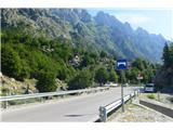 2
2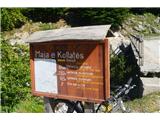 3
3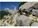 4
4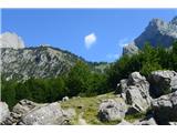 5
5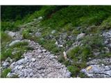 6
6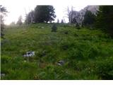 7
7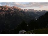 8
8 9
9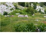 10
10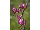 11
11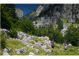 12
12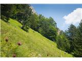 13
13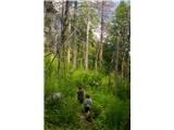 14
14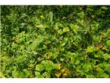 15
15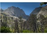 16
16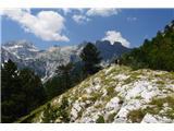 17
17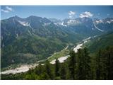 18
18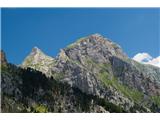 19
19
Discussion about the trail Valbonë - Viewpoint above Valbona (east path)