Passo di Giau - Rifugio Nuvolau (via Rifugio Averau)
Starting point: Passo di Giau (2233 m)
| Lat/Lon: | 46,4825°N 12,0538°E |
| |
Name of path: via Rifugio Averau
Time of walking: 1 h 40 min
Difficulty: partly demanding marked way
Altitude difference: 342 m
Altitude difference po putu: 500 m
Map: Tabacco 03 1:25.000
Recommended equipment (summer):
Recommended equipment (winter): ice axe, crampons
Views: 5.786
 | 1 person likes this post |
Access to the starting point:
First, drive to Cortina d'Ampezzo (you can get here via Border crossing Rateče or Predel to Trbiž / Tarvisio and then take the motorway towards Udine to the Tolmezzo exit. From Tolmezzo, follow the road towards Ampezzo and the Passo della Mauria mountain pass. The road then descends and leads to a crossroads where you turn left (possibly right) towards Cortina d'Ampezzo. At all subsequent junctions, follow the signs for Cortina d'Ampezzo. Or from the Primorska side, take the motorway towards Trieste. Continue on the Italian motorway towards Padua, but only as far as the motorway junction where you continue towards Veneto and Belluno. Near Belluno, the motorway ends and we continue towards Cortina d'Ampezzo at the next junctions and then follow the signs for the Passo di Falzarego Alpine pass. We then follow this ascending road to a junction at about 1400m. At the crossroads, turn left towards the Passo di Giau and the Marmolada. Park in the large parking lot on the aforementioned Alpine pass.
Path description:
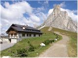
From the pass, continue along a wide path past the Rifugio Passo Giau hut. After a short climb along a wide path, you reach a crossroads where the 443 trail branches off to the right. We continue up the wide path, then the path becomes narrower and turns slightly left to the west side of Mount Ragusela. Here the path starts to descend and crosses the scree to the north. Later, the path starts to climb up a rather steep and also slightly crumbly slope, which then leads to grassy slopes. From the grassy slopes, you soon join the wide path from the Rifugio Fedare (2000m), followed by a short climb up to the Averau hut.
At the hut we continue south to the right and soon reach a fork where the 439 trail branches off to the left towards the Rifugio Scoiattoli hut (2225m). We continue along the broad ridge southwards until we reach the Nuvolau hut.
Pictures:
 1
1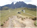 2
2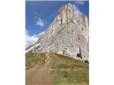 3
3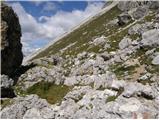 4
4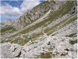 5
5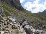 6
6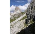 7
7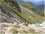 8
8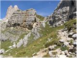 9
9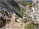 10
10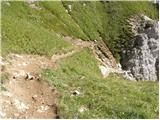 11
11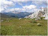 12
12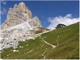 13
13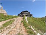 14
14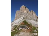 15
15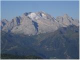 16
16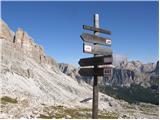 17
17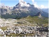 18
18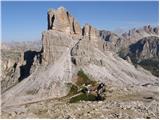 19
19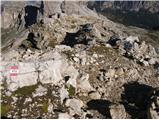 20
20 21
21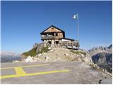 22
22
Discussion about the trail Passo di Giau - Rifugio Nuvolau (via Rifugio Averau)