Markova raven - Planina Koren (unmarked way)
Starting point: Markova raven (980 m)
| Lat/Lon: | 46,2969°N 14,5618°E |
| |
Name of path: unmarked way
Time of walking: 1 h 50 min
Difficulty: easy unmarked way
Altitude difference: 695 m
Altitude difference po putu: 695 m
Map: Kamniške in Savinjske Alpe 1:50.000
Recommended equipment (summer):
Recommended equipment (winter): ice axe, crampons
Views: 4.868
 | 1 person likes this post |
Access to the starting point:
Drive into Kamnik and follow the road towards the Kamniška Bistrica valley. Just a few tens of metres before the bottom station of the pendulum, a forest road branches off to the left down into the Korošica valley. The road then crosses a bridge and shortly afterwards comes to a crossroads where you continue straight ahead. The road then leads to a crossroads again. 1. Turn left over the bridge and follow the road uphill. The Markovo level can be identified by a small parking lot, a stream and a wide cart track which heads up to the left and the road starts to descend steeply. 2. Continue straight on and climb the road which leads to the next crossroads. Continue along the road on the left, which becomes very steep, and follow it to the parking lot at the left-hand bend, from which a wide cart track turns off straight ahead. Park in the roadside parking lot.
Path description:
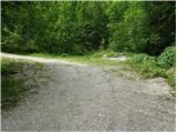
From the parking lot, take the wide cart track road, which after a few dozen metres leads to the next parking lot. Continue straight across the parking lot and continue up the cart track, which turns left. After a few minutes' walk, cart track has a crossroads where you take the marked cart track to the right. Follow this for a few minutes to where the footpath to Krvavec and mountain pasture Koren branches off to the right. The branch is not marked so you have to follow the signs carefully. The path continues up the right side of the torrent quite steeply. The path then leads us to a crossroads where we continue to the right in the route ZA VRATA. The way forward slowly passes into a less dense forest, so that we sometimes cross a small meadow or even a short scree slope. The views are also getting better. Next, the path leads us under the foot of a shorter wall from which an unmarked path branches off to the right up to mountain pasture Koren (straight marked path). Take the path to the right, which starts to climb crosswise on a scree slope, partly covered with grass. After a few minutes the path turns slightly right and crosses an undistinguished, already partially vegetated stream. Immediately afterwards, the path leads into the lane of a forest. Here is the crossroads of two unmarked paths. The left one, which is less visible, leads to mountain pasture Koren, while the right one (straight), which is slightly better, leads to Medvedja jama. Our left path then climbs up through the forest and after a few minutes leads us into a small valley. The path, which is quite overgrown and not very visible in places, leads us along the bottom of the valley by the torrent. The trail is getting worse and worse and leads us again to a crossroads which we can barely see. Take the very overgrown path to the left, which takes you through dwarf pines, a little further across the meadow to mountain pasture Koren.
PP: Orientation is difficult and I advise against taking this route in fog.

Pictures:
 1
1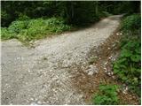 2
2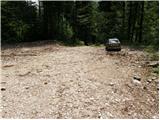 3
3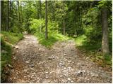 4
4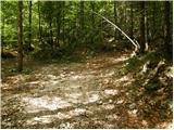 5
5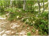 6
6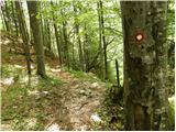 7
7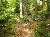 8
8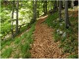 9
9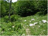 10
10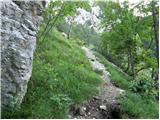 11
11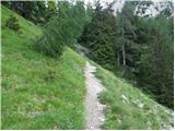 12
12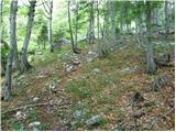 13
13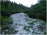 14
14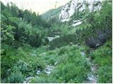 15
15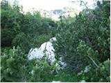 16
16 17
17
Discussion about the trail Markova raven - Planina Koren (unmarked way)
|
| pclop14. 06. 2020 |
Bil par dni nazaj na tej poti ... Imam malo težav, ker niti po objavljenih fotografijah, niti po zapisu nisem povsem prepričan, da je res to ta pot, a verjetno ni ravno veliko drugih možnosti. Vsekakor je pot od odcepa do razcepa (na vrhu "grebenčka") zelo jasna, tam na grebenčku (na vrhu serpentin po "melišču") kjer se na na desni v zrak dviga večja skalna gmota, pa je odcep na levo bolj slabo viden. Morda pa koga že sam spust navzdol proti Medvedji jami opozori, tako kot je mene, da bo pot napačna.
Od tega slabše vidnega odcepa na desno gre pot najprej med drevesi, potem pa po grapi navzgor, tik pred vrhom grape pa zavijete desno in po lepi poti pridete na rob, od koder kmalu zagledate planino Koren.
Pot ni ravno zahtevna, morda zaradi precejšnjih strmih pobočij v mokrem vremenu delno nevarna, jaz sem si zaradi lažje orientacije pomagal tudi z Googlovimi zemljevidi.
Je pa lepa alternativa markirani poti, tako da greš po tej varianti gor, po markirani pa dol, da se preveč ne ponavljaš. Srečno!
Še to, tam okrog odcepa od uradne poti je na zemljevidih na tej strani bolj pravilna tista črna pikčasta pot od tiste rdeče črte. Vsekakor je odcep malo pred koriti z vodo.
|
|
|
|
| pclop14. 06. 2020 |
"Od tega slabše vidnega odcepa na desno gre pot najprej med drevesi" - na tem razpotju neoznačenih poti v resnici zaviješ levo in ne desno.
|
|
|