Klippitztörl - Kienberg (Saualpe)
Starting point: Klippitztörl (1644 m)
| Lat/Lon: | 46,93637°N 14,67404°E |
| |
Time of walking: 2 h 20 min
Difficulty: easy marked way
Altitude difference: 406 m
Altitude difference po putu: 450 m
Map:
Recommended equipment (summer):
Recommended equipment (winter): ice axe, crampons
Views: 257
 | 4 people like this post |
Access to the starting point:
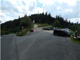
a) Drive through Border crossing Ljubelj into Austria and follow the signs for Klagenfurt am Wörthersee / Klagenfurt am Wörthersee. In Klagenfurt, turn right at the McDonalds onto the southern bypass / Südring, and at the next major junction turn right again towards Velikowiec / Völkermarkt and Mostič / Brückl. The road to Velikowiec is soon left, as a little after the Obi shop you turn right towards the motorway and Mostič. Continue past the Ikea store, following the signs for Mostič and past the motorway entrances. When you arrive in Mostič, follow the signs for Lead / Eberstein and Hüttenberg. Just before Hüttenberg, after Mösel, turn right towards Klippitztörl and Lölling. Further on, the valley of the Löllingbach stream begins to climb more visibly, and higher up, after the village of Lölling, you gradually move away from the stream. Follow this road as far as the Klippitztörl Pass, where you turn right and park in a large asphalt parking lot.
b) Take the Border crossing Jezerski Vrh, Holmec or Vič into Austria, then follow the signs for Velikovec / Völkermarkt and from there the signs for Mostič / Brückl. When you arrive in Mostič, follow the signs for Svinec / Eberstein and Hüttenberg. Just before Hüttenberg, after Mösel, turn right towards Klippitztörl and Lölling. Further on, the valley of the Löllingbach stream begins to climb more visibly, and higher up, after the village of Lölling, you gradually move away from the stream. Follow this road as far as the Klippitztörl Pass, where you turn right and park in a large asphalt parking lot.
Path description:
At the start of the parking lot, signs for Geierkogel, Wolfsbergerhütte, Forstalpe and other destinations direct you to a path that continues above the parking lot and leads south. At first you walk along a wide mountain path (not a road), which climbs only gently, but after crossing a dirt road the path gradually becomes slightly steeper and leads to a marked crossroads.
Continue along the right-hand path in the direction of the Wolfsbergerhütte hut (left-hand path over Geierkogel), which then crosses the slopes to the right in a steep ascent. A little further on, cross the forest road once more and then continue ascending for some time in a gentle cross-climb. After leaving the forest, the ascent is slightly steeper to an indistinct ridge, where a path about half an hour longer joins from the left and leads via Geierkogel.
Continue southwards, climbing moderately along a fence, which is then slightly to the right as you climb higher. As you climb to 2000 metres above sea level, you will soon see an interesting natural window on the right, where the Forstalpe summit seal is located. Continue along the marked trail and soon you will see a small rise on the left, where the highest point of the peak is located, and the peak is identified by the number 398.
From Forstalpe, the trail leads quite gently to the south-west and, after a grassy and partly marshy part, leads to the crossroads at Hafeneck, where you continue slightly to the right in the direction of Ladinger Spitze / Ladinger Spitz (Kleinhinterbergerhütte on the left).
The route continues without any major changes in altitude, the ridge narrows slightly further on, and the path leads us with a few short easy ascents and descents. Once we are fully approaching the grassy summit of Kienberg, the marked trail turns slightly to the right and bypasses the highest point, which is reached in less than a minute's walk from the marked trail.
Starting point - Forstalpe 1:40, Forstalpe - Kienberg 0:40.
Description and pictures refer to August 2020.

Pictures:
 1
1 2
2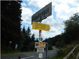 3
3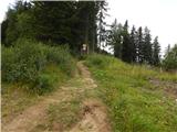 4
4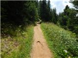 5
5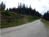 6
6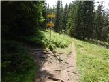 7
7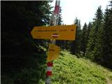 8
8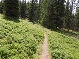 9
9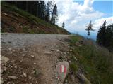 10
10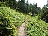 11
11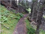 12
12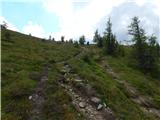 13
13 14
14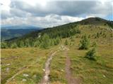 15
15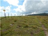 16
16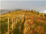 17
17 18
18 19
19 20
20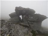 21
21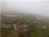 22
22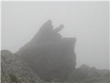 23
23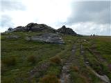 24
24 25
25 26
26 27
27 28
28 29
29 30
30 31
31 32
32 33
33 34
34 35
35 36
36 37
37
Discussion about the trail Klippitztörl - Kienberg (Saualpe)