Jezero - Sveti Tomaž (Planinca) (via Ledenica)
Starting point: Jezero (290 m)
| Lat/Lon: | 45,9692°N 14,4313°E |
| |
Name of path: via Ledenica
Time of walking: 1 h
Difficulty: easy marked way
Altitude difference: 282 m
Altitude difference po putu: 282 m
Map: Ljubljana - okolica 1:50.000
Recommended equipment (summer):
Recommended equipment (winter):
Views: 7.300
 | 1 person likes this post |
Access to the starting point:
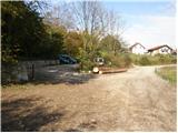
a) From the motorway Ljubljana - Koper, take the exit Brezovica, from where you turn left along the old road towards Vrhnika. While still in Brezovica, you will see signs for Podpeč, which will direct you to the left. Continue through Vnanje and Notranje Gorice to Podpeča, where at the crossroads turn left towards the village of Jezero. Follow the road through the village for a few 100 m, after which the signs for Podpeško jezero point to the right. Follow the slightly narrower road to the parking lot at Lake Podpeško.
b) From Ljubljana, take the road to Črna vas and then continue to Podpeč, where you join the road from Brezovica. In Podpeč, turn left again (direction Jezero). Continue for another 100 m, then the signs for Podpeško jezero direct you to the right onto a slightly narrower road, which you follow to the parking lot by the aforementioned lake.
Path description:
From the parking lot we return about 100m back to the crossroads, where we see signs for Krim. Continue on the asphalted road that leads up through the village. After a few minutes of walking, the asphalt ends and the road quickly turns into cart track, which leads us to a crossroads. Continue along the left path towards the Ice Cave (Krim left and right). Continue following cart track, which climbs moderately through the forest and leads us slightly higher to a crossroads. If you wish, you can make a short detour to the Ice Cave, which takes just over five minutes each way.
Otherwise, continue right along the path, which soon leads us to a forest road which we follow up to a small hamlet. Here we also come to a crossroads on the trail, where we continue to the left in the direction of Krima. The path then leads us after a few metres to the Church of St Thomas, which we can see in front of us.
Pictures:
 1
1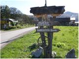 2
2 3
3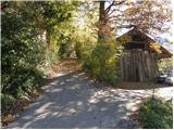 4
4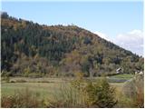 5
5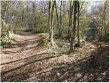 6
6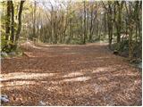 7
7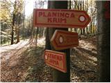 8
8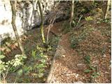 9
9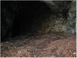 10
10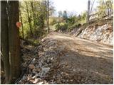 11
11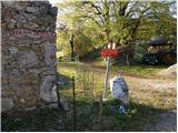 12
12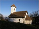 13
13
Discussion about the trail Jezero - Sveti Tomaž (Planinca) (via Ledenica)