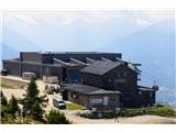
Upper station of Patscherkofelbahn cableway - Glungezer Hütte
Starting point: Upper station of Patscherkofelbahn cableway (1965 m)
| Lat/Lon: | 47,21012°N 11,45202°E |
| |
Time of walking: 2 h 45 min
Difficulty: easy marked way
Altitude difference: 645 m
Altitude difference po putu: 680 m
Map:
Recommended equipment (summer):
Recommended equipment (winter):
Views: 603
 | 2 people like this post |
Access to the starting point:
If you take the motorway along the Inn River, take the Innsbruck-Mitte exit. If you are already in Innsbruck, head south towards the Innsbruck-Mitte exit, but do not take the motorway. Then follow the signs for Igls or Innsbruck-Igls and, higher up the mountain, the signs for the Patscherkofelbahn cable car. Park at the lower station of this cable car (large parking lot) and take the "egg" to the upper station.
Path description:
From the top station of the Patscherkofelbahn cable car, head east along the Zirbenweg ('Cemprin Trail'; the cemprin is a rare species of pine), a gentle and undemanding route that takes you over the northern slopes of the Patscherkofl, through open terrain, incredibly rich in rhododendron. Every now and then, the distinct horn of Sonnenspitze Peak appears far behind us, and to the right of it, the saddle that is our final destination. We gain only a few metres of altitude to the distinct saddle of Boscheben (2035 m) to the east below Patscherkofl (at the saddle, on the right, we turn off for the hut of the same name, which is a few minutes' walk). 0:45 to here.
Continue over a forest steel cable and then a little more undulating up and down over a rock step. Shortly after, some 20 minutes' walk from the Boscheben saddle, we come to a valley where the path splits: the Zirbenweg tourist path turns sharp left and our route continues straight on (signposted Glungezerhütte). From the split, we climb first gently along the valley floor, and soon steeply up the valley's left-hand slope. Higher up, the path flattens out again and you cross to the right around the Viggarspitze summit (a quick hike to this summit is also possible; approx. 15 minutes ascent). There follows a long, steady, gentle climb up an unpaved, south-west-facing slope on a mostly rocky path.
In the last third of the tour, however, the path goes up a little more concretely. After crossing the last gullies, the last 150 metres of purely rocky ascent are crossed in a zig-zag. Looking over the edge at the saddle, you see the Glungezerhütte hut. It is reached by a short passage through a mini-valley.
Two additional suggestions: From the hut it is possible to climb quickly and easily to the two nearby peaks. The more rounded Glungezer (10 minutes; from the top there are views along the ridge to the south; on the summit there is a memorial to the 1964 plane crash - see description of the hut) is ascended from behind the hut in a south-easterly direction. The more adventurous Sonnenspitze (10 minutes; excellent view north) is ascended from the bivouac next to the hut in a westerly direction.

Pictures:
 1
1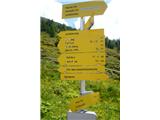 2
2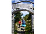 3
3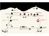 4
4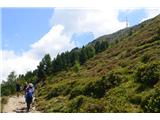 5
5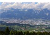 6
6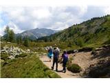 7
7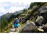 8
8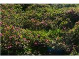 9
9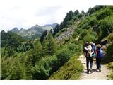 10
10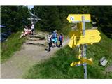 11
11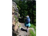 12
12 13
13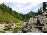 14
14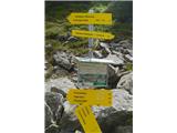 15
15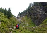 16
16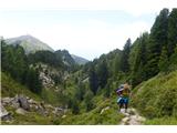 17
17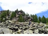 18
18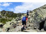 19
19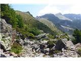 20
20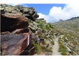 21
21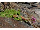 22
22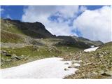 23
23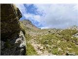 24
24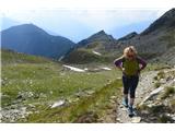 25
25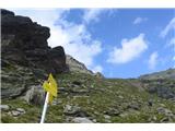 26
26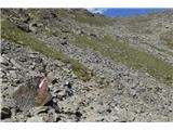 27
27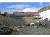 28
28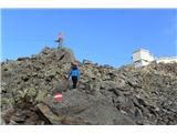 29
29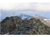 30
30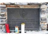 31
31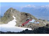 32
32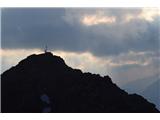 33
33 34
34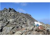 35
35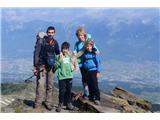 36
36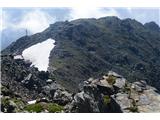 37
37
Discussion about the trail Upper station of Patscherkofelbahn cableway - Glungezer Hütte