Branik - Sveti Duh (Pedrovo) (by cart track)
Starting point: Branik (87 m)
| Lat/Lon: | 45,8608°N 13,7861°E |
| |
Name of path: by cart track
Time of walking: 1 h 10 min
Difficulty: easy marked way
Altitude difference: 278 m
Altitude difference po putu: 305 m
Map: Goriška - izletniška karta 1:50.000
Recommended equipment (summer):
Recommended equipment (winter): crampons
Views: 3.459
 | 2 people like this post |
Access to the starting point:
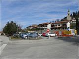
a) From the motorway Ljubljana - Koper, take the exit Senožeče and then continue driving towards the village of Štorje. At Štorje, turn right in the direction of Branik (straight ahead to Sežana and Trieste) and continue through the villages of Kazlje, Dobravlje and Ponikve. At the junction a few kilometres after Ponikve, turn right towards the village of Kobdilj (left Kopriva and Dutovlje), and from there follow the signs for Štanjel and Branik. After a few kilometres downhill, we arrive at Branik, where the road from Komno joins from the left. Just a little further on from this junction, you will see a larger parking lot on the right, where you park (the parking lot is located near the post office and the Mercator store).
b) First drive to Ajdovščina, then continue along the old road towards Nova Gorica. When you reach Potoče, leave the main road and turn left towards Branik. The road quickly leads to a bridge over the river Vipava, after which it gradually becomes more winding. After a short climb, there is a short descent and you reach Branik. When you reach the main road, turn left and then after a few 10 metres of further driving, turn left into a larger parking lot (the parking lot is located near the post office and the Mercator shop).
c) From Nova Gorica or its surroundings, drive to Dornberk and from there continue in the direction of Branik. Park in the centre of Branik in a large parking lot (located near the post office and the Mercator store).
Path description:
From the parking lot, continue along the pavement, which leads along the main road towards Štanjel, Koper and Sežana, where you will see several monuments, including the monument to Simon Gregorčič. A little further on, cross the main road at a pedestrian crossing and we continue in the same direction. At a slightly larger junction, continue straight on towards Komno (slightly left along the main road Štanjel, Koper and Sežana), and we walk along the pavement for a few more minutes, then signs for the railway station direct us to the right onto a slightly narrower road. Walk along the road towards the railway station until the first right turn, and from there continue straight on towards the Bor-Les furniture factory.
From Bor-Les, continue straight ahead on a minor road, which quickly leads to the foot of the railway line. Here the road turns left and continues parallel to the railway for a short distance, then turns right, where it leads under a separating bridge. Just after the bridge, go right along the wider cart track, which turns left a few 10 steps further on and starts to climb crosswise (the route up to this point has not been marked, but further on we will be accompanied by "markings" in the form of a red circle in the middle of which is a green butterfly). Continue cross-climbing above the Petnik stream, and the path leads us higher up to a ridge where another path from Branik (the path past the hamlet of Cvetrož) joins from the right. From the crossroads, walk along the ridge for a few more steps, and then you will arrive at the point where cart track splits into two parts: the cart track. Continue along the right-hand cart track (the left-hand one leads directly to the village of Pedrovo and is better marked), which immediately splits again. At the second crossroads, continue left, then slightly right at a slightly higher level (possibly also straight ahead). Continue climbing moderately through the forest along cart track, which joins another cart track higher up. Continue left here to a nearby abandoned byte, where you will see a marker. After the byte, cart track descends and rejoins the Petnik stream bed. Cross the stream in a long arc, then on the other side begin to climb cross-country towards the village of Pedrovo, which is reached after a few minutes' further walking. When you reach the village, you reach it at the last house, continue left (right Trstelj) and descend through the village to the end or beginning of the village, where you see the Church of the Holy Ghost on the right hand side.

Pictures:
 1
1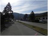 2
2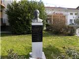 3
3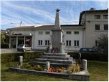 4
4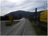 5
5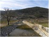 6
6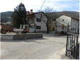 7
7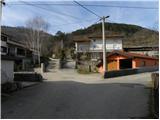 8
8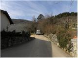 9
9 10
10 11
11 12
12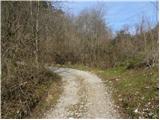 13
13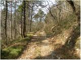 14
14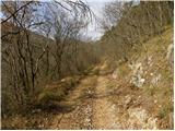 15
15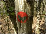 16
16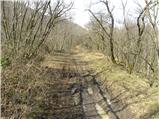 17
17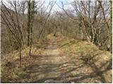 18
18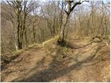 19
19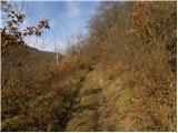 20
20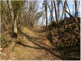 21
21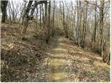 22
22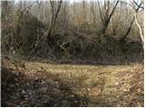 23
23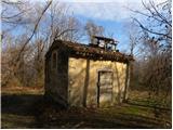 24
24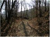 25
25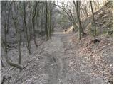 26
26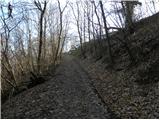 27
27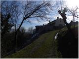 28
28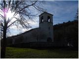 29
29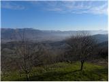 30
30
Discussion about the trail Branik - Sveti Duh (Pedrovo) (by cart track)
|
| darh12. 03. 2014 |
V nedeljo smo se tudi mi iz Branika povzpeli do Pedrovega, le da smo večinoma izbirali alternativno pot tu opisani, torej mimo Cvetroža in potem levo po bolje markirani poti do Pedrovega. Poleg tega smo pot nadaljevali še naprej do vrha Šumke in se vrnili naokrog mimo gradu Rihenberk. Tu je objavljen podrobnejši opis naše poti s slikami.
|
|
|